Historically, civil engineering and subsurface utility mapping operated in silos. Topographic crews mapped above-ground site features like curbs, grade breaks, and structures, while geophysics teams mapped buried utilities, voids, and rebar. Attempting to combine these distinct datasets into a single 3D model often resulted in coordinate misalignments, spatial gaps, and fragmented deliverables.
By pairing high-precision Emlid Reach RS4 surface positioning with Geolitix advanced geophysical processing software, field teams can now seamlessly merge above-ground reality captures with below-ground radar and electromagnetic data into a unified 3D digital twin.
| Digital Twin Layer | Hardware & Software Stack | Primary Data Output |
| Above-Ground Reality | Emlid Reach RS4 RTK GNSS + Photogrammetry / LiDAR | Centimeter-accurate surface DEM, grade contours, surface features |
| Below-Ground Reality | GPR / EM arrays processed in Geolitix | 3D subsurface utility depth models, void volumes, layer interfaces |
| Unified 3D Digital Twin | Geolitix Cloud Engine + CAD / BIM Integrations | Fully geo-referenced 3D site model combining surface & subsurface |
Unifying Topography and Subsurface Analytics
Creating a true digital twin requires eliminating spatial uncertainty between what sits above the ground and what lies beneath it:
Centimeter-Accurate Surface Control: The Emlid Reach RS4 acts as the geodetic anchor for the entire job site. Utilizing all-band tracking (including L5/L6 signals) and tilt compensation, the RS4 rapidly logs surface control points, ground elevations, and scan boundaries across challenging terrains or urban canyons.
Automated Subsurface Feature Extraction: Geolitix processes complex ground penetrating radar (GPR) and electromagnetic data using automated cloud processing. It detects, traces, and converts raw radar reflections into continuous 3D pipe and utility polylines.
Georeferencing Alignment: Because Geolitix ingests precise spatial coordinates logged by Emlid GNSS receivers, underground GPR slices and utility vectors map directly to the actual ground elevation model (DEM) captured by the RS4, eliminating vertical depth offset errors caused by varying topography.
Building the Comprehensive Site Model
Combining Emlid RS4 positioning with Geolitix processing transforms raw field scans into an interactive, complete 3D model. Field teams can import RS4 elevation models directly into Geolitix, allowing the software to adjust underground utility depth profiles according to true ground surface changes rather than assuming flat ground.
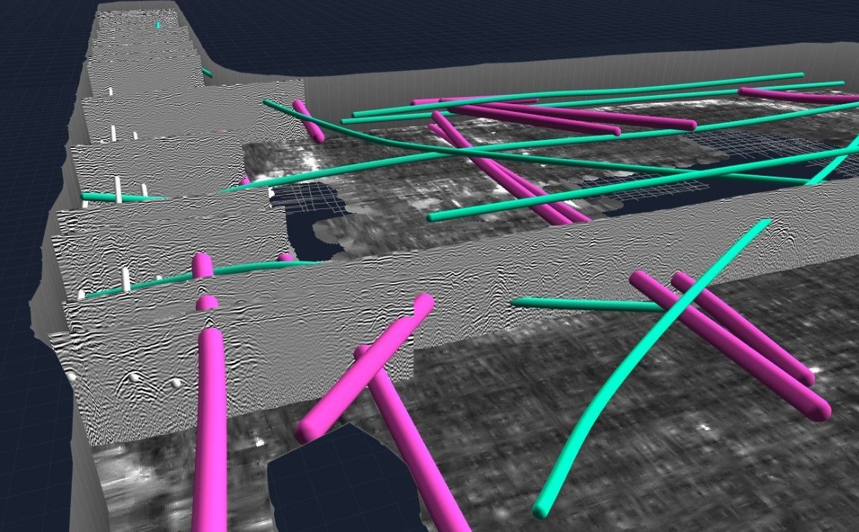
This merged spatial intelligence empowers civil engineers, surveyors, and GIS specialists to inspect utility cover depths, execute clash detection before excavation, and export complete 3D models directly to CAD, BIM, or GIS platforms.
Watch the Emlid Reach RS4 Precision On-Site Demo to see how the Reach RS4 GNSS receiver captures reliable, centimeter-level surface coordinates in challenging field environments.
This video demonstrates the core surface data collection capabilities of the Emlid Reach RS4, which serves as the precise spatial anchor required when merging surface terrain with subsurface GPR data in Geolitix.