Walk down any city street preparing for construction, and you’ll see it: a neon patchwork of pink, blue, yellow, and red spray paint. For decades, these painted lines—the universal language of utility locating—have been the final line of defense between an excavator bucket and a catastrophic utility strike.
But as major construction projects grow larger, more crowded, and digitally integrated, the humble spray can is meeting its match.
Today, the world's most progressive job sites are moving beyond the paint. In its place, engineering and construction firms are adopting 3D subsurface modeling—turning invisible, underground chaos into highly accurate, interactive digital twins.
Here is why 2D markings are fading out, and how 3D models are redefining damage prevention on major job sites.
The Flaws of the Neon Future: Why 2D Paint Fails
Traditional utility marking relies on a locator finding a line, walking the site, and spraying a mark on the ground. While this system has saved countless lives and utility lines over the years, it has three critical vulnerabilities on major project sites:
The Vanishing Act: Construction sites are harsh environments. Between heavy rain, mud, constant traffic, and asphalt milling, paint lines can disappear within days—or even hours—requiring costly and time-consuming re-marks.
The Missing Z-Axis: Paint only tells you where a utility is horizontally. It tells you absolutely nothing about depth. A contractor might know a water line is under their feet, but they don't know if it’s 2 feet down or 12 feet down until they start digging.
Human Misinterpretation: On complex sites with dozens of overlapping utilities, the ground quickly turns into an illegible bowl of neon spaghetti. One misread line can lead to a multi-million-dollar disaster.
What is a 3D Subsurface Model?
Instead of treating underground infrastructure as a flat map, a 3D subsurface model treats it like a subterranean building. By combining historical records, geophysical data (Quality Level B), and precise vacuum excavation data (Quality Level A), engineers build a true-to-life 3D digital representation of the underground environment.
This model is then integrated directly into the project’s Building Information Modeling (BIM) ecosystem.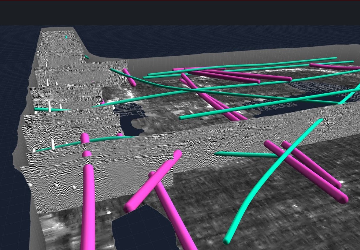
Why Major Construction Sites Are Making the Switch
On mega-projects—like airport expansions, transit corridors, or massive industrial plants—the ROI of switching from paint to pixels is undeniable.
1. Pre-Construction "Clash Detection"
In the past, crews discovered that a new storm drain collided with an old gas line only when the excavator physically hit it or hit a dead end. With a 3D model, engineers can run automated clash detection software before ground is ever broken. The computer flags the conflict digitally, allowing the team to redesign the route in office chairs rather than solving it during an emergency field shutdown.
2. Direct Integration with Machine Control
Modern heavy machinery is incredibly smart. Many modern excavators are equipped with GPS-guided machine control systems. By feeding the 3D subsurface model directly into the excavator’s onboard computer, the machine itself becomes a safety barrier. Operators can see the exact depth of the utilities on a screen in their cab, and some advanced systems can even automatically restrict the bucket from digging past a certain depth.
3. Augmented Reality (AR) in the Field
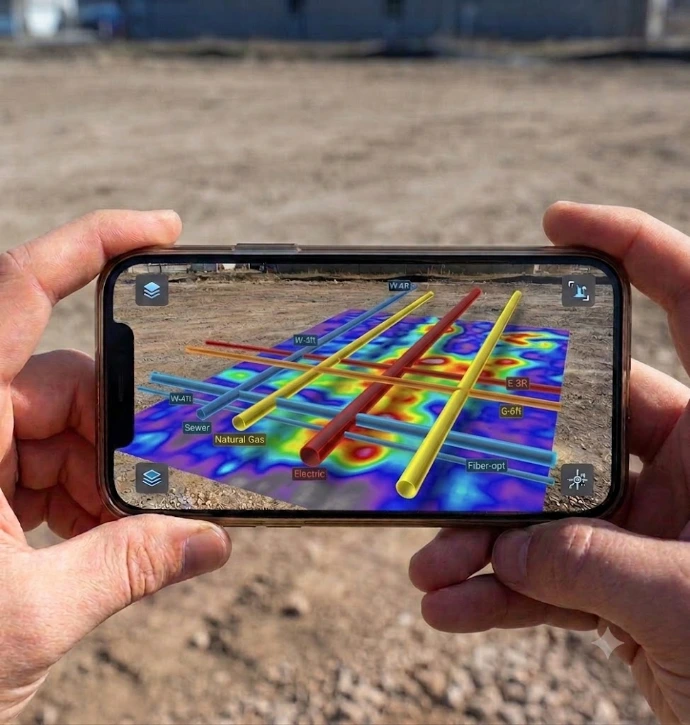
Instead of guessing where a painted line went, field superintendents can now hold up a tablet or wear smart glasses to look at the ground. Using Augmented Reality, the 3D model overlays the exact location and depth of the utilities right onto their real-world view.
Seeing is Believing: With AR, a supervisor can look at an empty dirt lot and see a virtual, color-coded 3D map of the water, electric, and fiber-optic lines running beneath their boots.
At a Glance: 2D Paint vs. 3D Subsurface Models
| Feature | Traditional 2D Paint Markings | Modern 3D Subsurface Models |
| Dimensions | 2D Only (Horizontal Location) | 3D (Horizontal, Vertical, & Diameter) |
| Permanence | Temporary (Washes away, paved over) | Permanent (Digital record for project lifecycle) |
| Clash Detection | Manual, visual inspection in the field | Automated via software before digging |
| Accessibility | Only visible to people standing on site | Shareable globally with engineers, owners, and crews |
| Automation Link | None | Syncs with GPS-guided smart excavators |
The New Standard for Damage Prevention
Spray paint will likely always have a place for quick, localized utility checks. But for major construction sites where a single utility strike can derail a timeline and jeopardize worker safety, relying solely on paint is becoming a relic of the past.
By investing in 3D subsurface models, the construction industry is finally bringing the underground world into the digital age—ensuring that what is built below is just as precise as what is built above.