The Challenge: A Forested Historic Landmark
Bigman Geophysical was recently contracted by the City of Johns Creek to perform a comprehensive geophysical investigation of the 1.92-acre Macedonia African Methodist Church Cemetery. The site, which dates back to ownership between 1881 and 1905, has suffered from decades of disrepair, making it difficult to identify and preserve gravesites and markers.
The primary challenge was the environment itself. A dense tree canopy created consistent difficulties for standard GPS accuracy, while the subsurface was filled with countless anomalies caused by historical logging and complex root growth. To ensure a definitive map for the city and the descendants of those interred, our team needed to distinguish between these natural features and man-made burials.
Bringing the Tech
Multichannel ground-penetrating radar is the most powerful geophysical tool available for precise, detailed imagery of unmarked graves.
Our Multi-Prong Approach
To navigate the complex terrain, we deployed a specialized suite of technology:
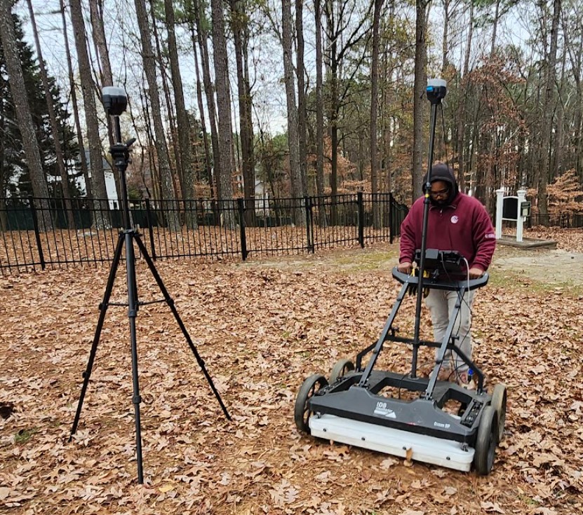
IDS Stream DP: This multichannel GPR system utilized 30 cross-polarized 600 MHz antennae to provide extremely high-resolution top-down imagery (time-slices), allowing our team to see the rectangular shapes of grave shafts with high clarity.
Chaser XR: For the southern end of the site, where heavy brush and steep slopes prevented the use of larger equipment, we deployed the Chaser XR. Its sled-configured design allowed it to maneuver over roots and deadfall while collecting high-quality data at 900 MHz.
Precision Geolocation: Both systems were integrated with Emlid RS3 GNSS receivers receiving Real-Time Kinematic (RTK) corrections to ensure every identified feature was accurately georeferenced for the city’s GIS department.
Expert Ecological Consultation: When initial scans revealed semi-regularly spaced anomalies at depths of four feet, we collaborated with Joshua Horwitz of Xylo Logics. As a specialist in GPR root analysis, Mr. Horwitz helped corroborate that these specific responses were actually decomposing root balls from historical logging events rather than unmarked graves.
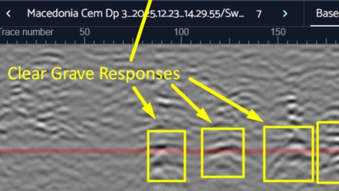
Clean Profiles
Radar cross sections imaged targets with precision to record depth, size, and shape of buried objects throughout the site.
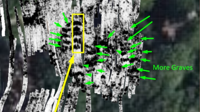
Top-Down Imagery
High-resolution images take the guess work out of drawing plot maps of individual graves, even in lumpy forest floors.
Precise Interpretations
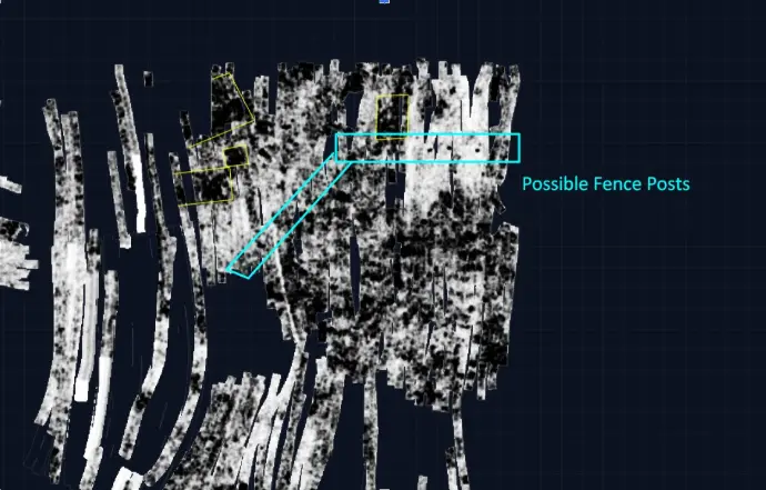
With the level of detail our technology records, even features as small as old fence posts can be mapped, showing the old cemetery boundary.
Detailed Results: Mapping the Hidden History
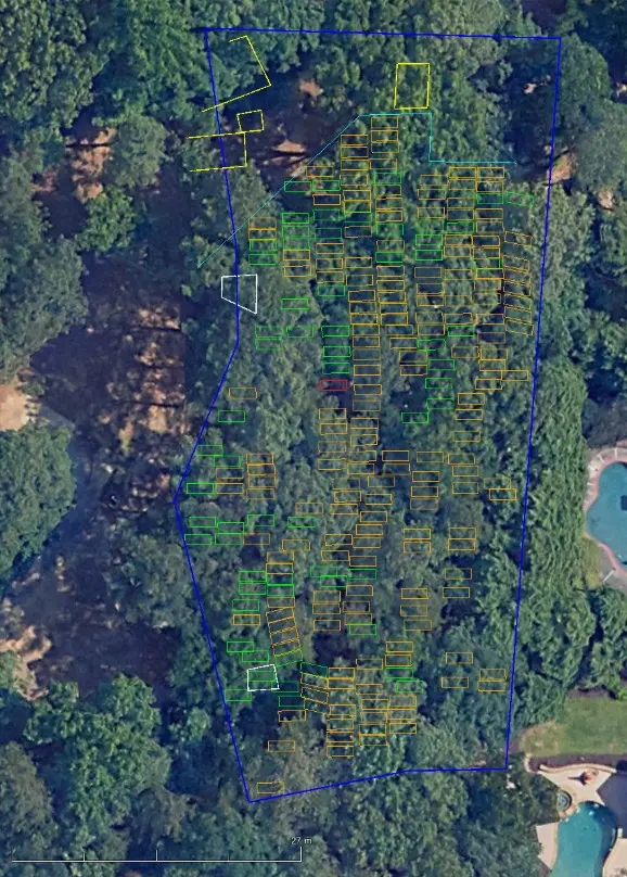
The investigation produced a highly detailed map of the cemetery’s subsurface, providing several key discoveries:
Verified and Unmarked Graves: Our team identified 65 existing burial markers that were still in-situ or close to their original locations. Beyond these visible markers, we flagged 177 high-probability targets as unmarked graves located within the fenced area. These were systematically placed and clearly visible as rectangular shafts in the multi-channel data.
Lost Architectural Features: In the northern end of the cemetery, we discovered several large, high-amplitude rectangular features. These responses are consistent with buried architecture or debris rather than individual graves, likely representing the remains of the original church building and its associated outbuildings.
Historical Boundaries: Our analysis revealed a series of very small, faint reflections occurring in a conspicuously straight line immediately outside the area where graves were recorded. These are interpreted as the remains of original fence posts from a lost historical boundary of the cemetery.
Distinction of Anomalies: While some low-probability targets were found outside the current fence line, they lacked the systematic placement and rectangular characteristics of the burials found inside. By ruling these out as natural features, we provided the city with a more accurate and reliable plot map.
By combining advanced multichannel GPR technology with expert arborist consultation, Bigman Geophysical was able to provide the City of Johns Creek with an actionable, high-confidence report that honors the site’s history and will guide future preservation and memorialization efforts.