In the world of subsurface utility mapping, detecting a buried pipe is standard procedure. But what happens when the goal isn't merely to find the pipe, but to identify a hidden, highly localized flaw inside of it?
In a recent project detailed in a Bigman Geophysical investigation report, the team demonstrated how pushing the boundaries of Multichannel Ground Penetrating Radar (GPR) can characterize targets in ways that traditional utility locating simply cannot match.
The Challenge: A Needle in a Subsurface Haystack
Bigman Geophysical was brought on site by AllSouth Sprinkler Company to investigate a problematic water line supplying fire sprinklers off I-20. The primary target was a partially closed valve or clog within a 6-inch water pipe buried approximately 3 to 4 feet deep.
The client acknowledged upfront that this small internal anomaly would be exceptionally difficult to isolate. While standard utility locating tools—like Electromagnetic (EM) locators—are effective at tracing conductive lines horizontally across a site, pinpointing the internal status or localized physical condition of a buried pipe requires a far more advanced approach.
Breaking Tradition: The Diagonal Approach
Standard GPR utility locating typically relies on scanning the ground using 90-degree perpendicular cross-sections over a suspected utility. While this confirms the horizontal route and depth of the pipe, it only provides a brief, instant snapshot of a single, narrow slice of the line.
To extract deeper intelligence, Bigman Geophysical executed a highly unconventional survey strategy: innovative diagonal cross-sections.
By traversing the pipe at 45-degree angles, the field team examined the utility in an elongated direction. This shift in methodology provided critical advantages:
Expanded Sampling Area: Traversing diagonally samples a significantly larger portion of the pipe structure and surrounding backfill material at every pass.
Increased Anomaly Detection: By imaging more pipe volume per scan, the equipment had far more opportunity to catch subtle variations in the radar signal that a standard 90-degree pass would miss completely.
Walking the Line: Longitudinal GPR Scanning
"The survey design used innovative diagonal cross sections meant to examine the pipe in an elongated direction, rather than the typical 90 degree cross section usually used for utility location." — Bigman Geophysical Investigation Report
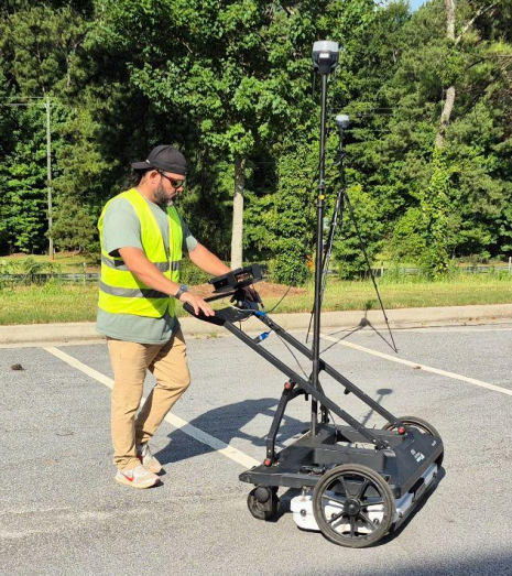
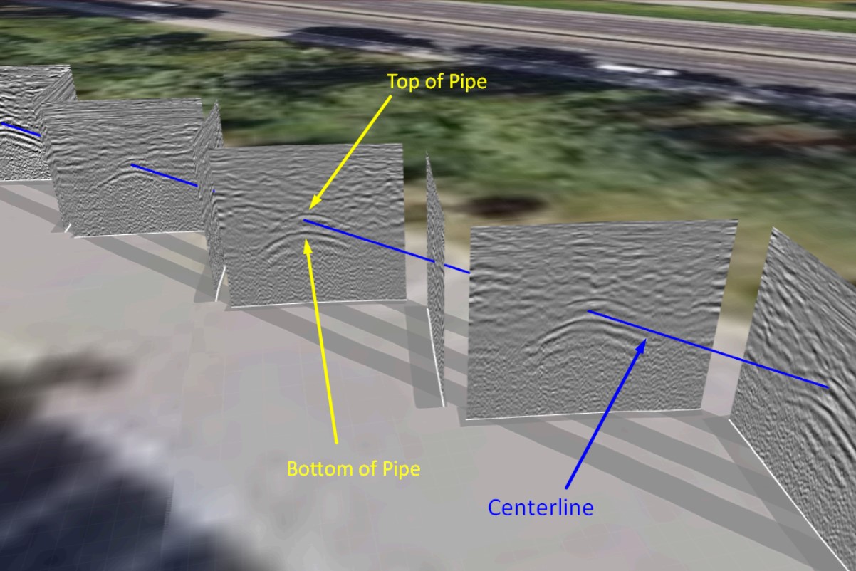
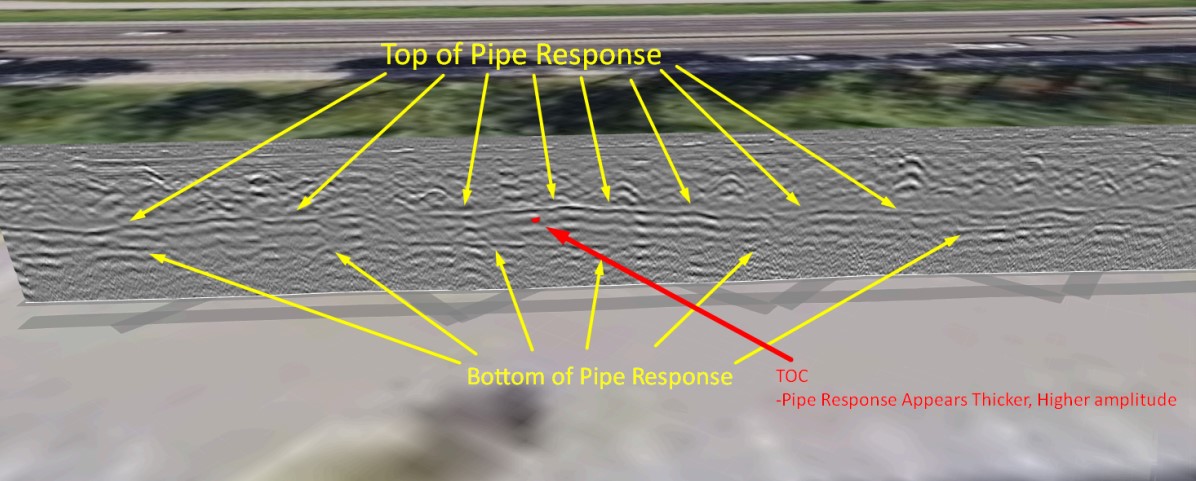
Bigman Geophysical didn't stop at diagonal passes. Utilizing a Stream DP multichannel GPR system, the team located the line and then rolled the array directly down the length of the pipe centerline to record a continuous longitudinal cross-section.
When post-processing the data, the true power of this technique became clear:
Identifying the Signature Shift: In the longitudinal profile, a specific section of the pipe registered a thicker, higher-amplitude (brighter) reflection.
Characterizing the Target: Because a physical pipe doesn't suddenly change diameter underground, this dramatic shift in GPR velocity and reflectivity points directly to localized moisture changes and wave velocity variations—clear geophysical indicators of a blockage or pipe damage.
Synthesizing Data for Precision Excavation
To ensure maximum confidence before ground was broken, Bigman Geophysical integrated multiple methods:
Acoustic Leak Detection: Acoustic instruments were applied systematically to match sound vibrations from fluid blockages or leaks with the visual GPR anomalies.
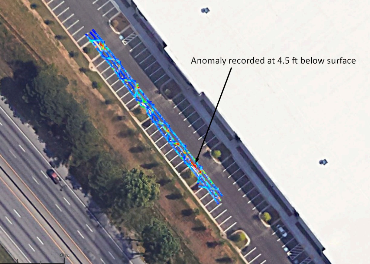
3D Time-Slices (C-Scans): Top-down data processing confirmed a distinct subsurface anomaly centered at a depth of about 4.5 feet.
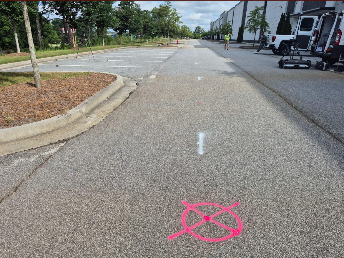
The team painted the exact Target of Concern (TOC) directly on the asphalt, providing the client with a precise focal point for excavation rather than requiring expensive, exploratory trenching.
The Takeaway
This project highlights why Bigman Geophysical continues to lead in complex utility characterization. By stepping away from basic 90-degree utility tracing and fully leveraging Multichannel GPR via diagonal and longitudinal scanning, they transform standard radar data into actionable, high-resolution subsurface insights.