The Mystery of the Shifting Ice: How 3D GPR Saved a Curling Rink
Curling is a game of absolute precision, where even a tiny imperfection on the ice can completely alter the trajectory of a stone. The playing surface must be completely flat. So, when the ice management team at a curling rink in Detroit, Michigan noticed subtle, mysterious "heaves" buckling their pristine surface, they knew they needed to look beneath the floor to find out what was going on.
To solve this subsurface puzzle, Zeke Hurd of Pegasus Environmental collaborated with Dr. Sean McConnel from Bigman Geophysical. Their mission was to look straight through the concrete and map the underlying environment in full 3D.
The Subsurface Toolkit
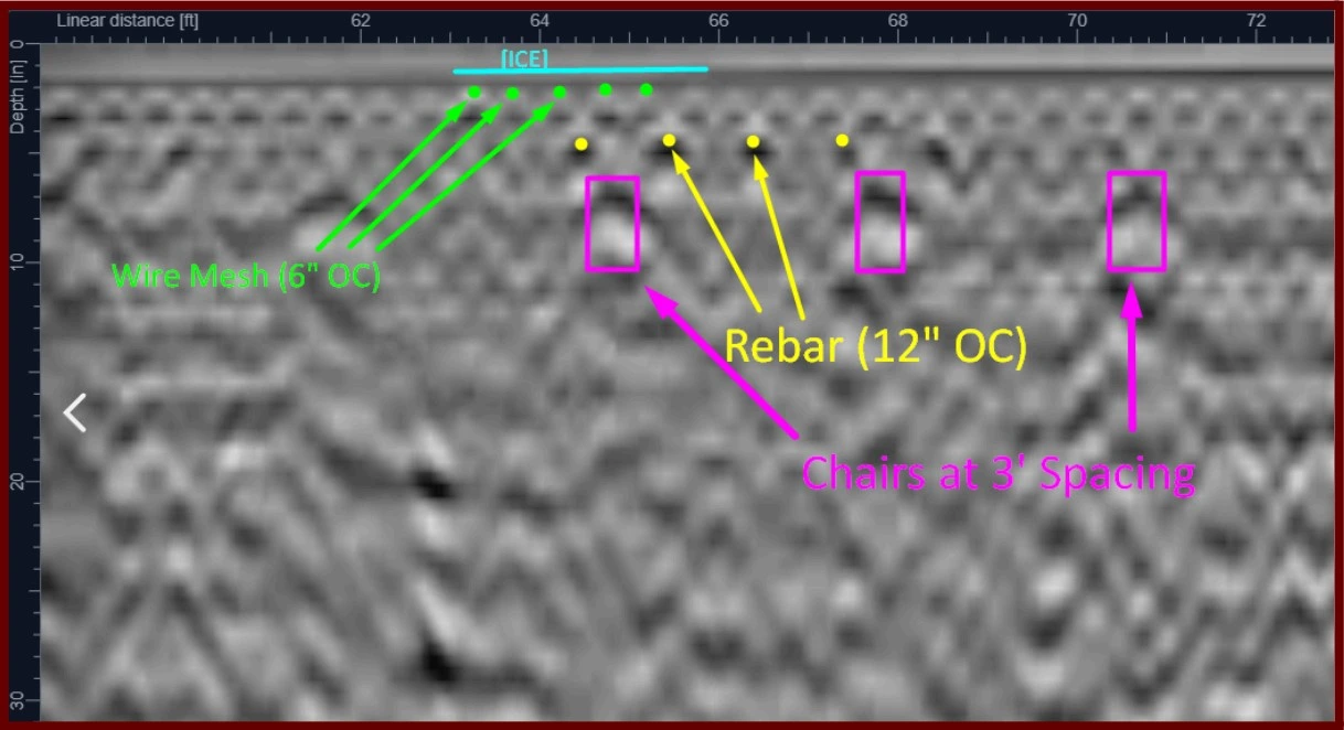
The rink, originally constructed by Burley's Rink Supply, presented a complex challenge. Beneath the ice lies a thick concrete slab packed tight with structural rebar and specialized glycol cooling lines. Tearing up the floor to find a problem would cost a fortune and destroy the facility for the season.
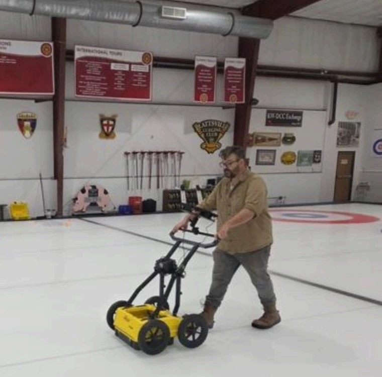
Instead, the team deployed the Leica DS4000 GPR platform. This advanced radar cart uses Equalized Scramble Technology (EST) to achieve the ultimate geophysical holy grail: penetrating deep into the earth to find deep structures while simultaneously capturing ultra-high-resolution details right near the surface. Just as importantly, the DS4000 was highly capable of filtering out the intense electromagnetic "noise" generated by the heavy steel mesh and structural members woven throughout the floor.
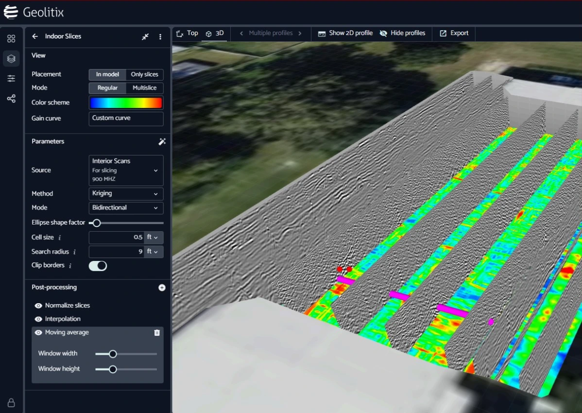
To turn these millions of raw radar reflections into a clear, interactive map, the team processed the data using post processing software to construct a model of the subsurface as an interactive 3D volume.
Pivoting in the Field
The initial plan was straightforward: scan a tight grid pattern across the indoor ice sheet. However, as the radar rolled across the floor, anomalous signatures started lighting up the screen right along the outer boundaries of the rink.
The field team quickly hypothesized that the issue might not be starting under the rink, but rather outside of it. They suspected that storm water runoff from the building's massive roof downspouts might be overwhelming the perimeter drainage, leaking underneath the foundation, and freezing.
Trusting their instincts, the team extended the scope of the project right there on the spot, mapping out two additional outdoor scanning grids along the exterior walls to catch the culprit in the act.
The Subsurface Culprits: 4 Key Anomalies
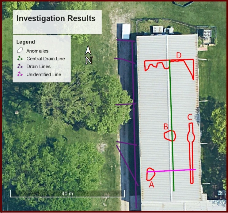
When the data was processed and viewed from above, the 3D volume isolated four distinct areas of concern hiding below the surface:
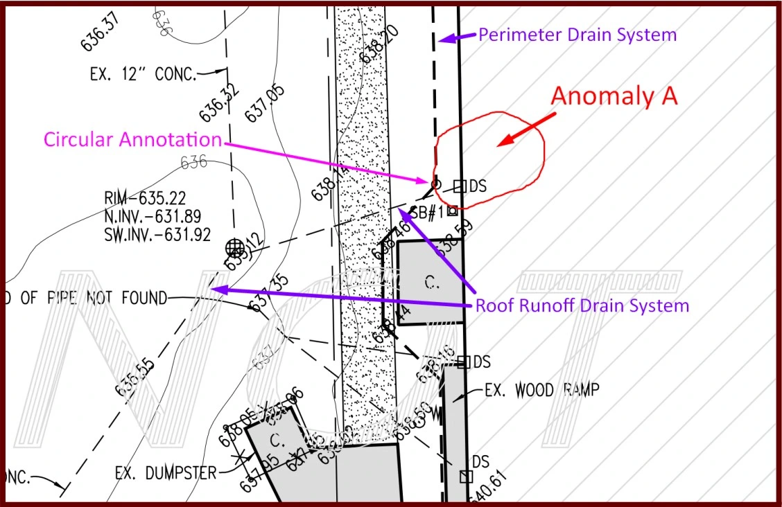
Anomaly A: The Phantom Pipe & Hidden Void
What the radar saw: Located along the southwest edge of the rink, GPR revealed a high-amplitude anomaly floating between 32 to 60 inches deep. In the cross-section data, this signature looked exactly like an underground void space hollowed out by a water leak.
The Root Cause: Directly beneath this void, the radar locked onto a weak but highly consistent linear feature buried 50 inches deep traveling straight across the rink from east to west. This line did not exist on any modern drainage maps provided by the facility. It appears to be an abandoned, unrecorded utility pipe that is actively supplying water directly under the slab—right next to an external roof downspout. This excess moisture potentially causing localized ice buildup and surface heaving.
Anomaly B: A Central Drain Distress Call
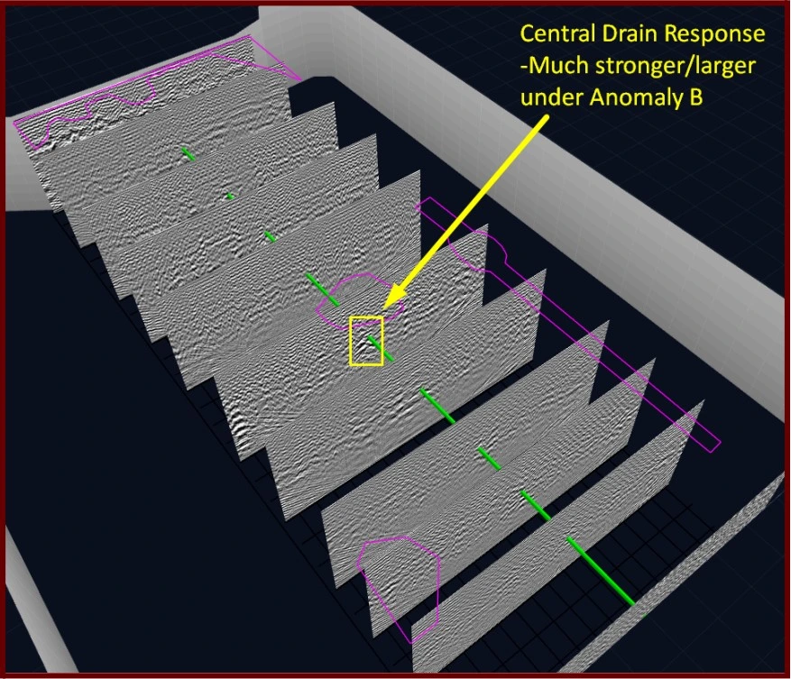
What the radar saw: Right down the center of the rink sits a primary longitudinal drain tile designed to control moisture. Across most of the site, this polymer line was barely visible, likely because it is heavily silted up over time. But in one specific central location, the drain suddenly gave off a massive, incredibly bright reflection.
The Root Cause: This hyper-bright reflection is a classic indicator of a trapped air pocket. The anomaly directly correlates to a section of the slab showing visible signal banding and minor heaving. The data indicates a structural failure or a broken pipe junction at this exact central intersection, which has been introducing water into the surrounding base material.
Anomaly C: Flexing Tubes & Ice Pockets
What the radar saw: The team identified a 3-foot wide section running down the length of the rink where the data signatures of the cooling tubes looked strangely distorted.
The Root Cause: When they looked at a horizontal, top-down 3D slice of the data, they discovered a distinct circular patch immediately below the concrete slab with an intense reflection signature—a textbook sign of a localized ice pocket forming in the insulation layer.
The Silver Lining: Despite the ice pocket pushing the components out of alignment, the facility hadn't reported any drop in cooling fluid levels. Thanks to the highly flexible composite materials used in modern rink construction, the cooling tubes successfully bent with the ice heave without actually cracking or breaking.
Anomaly D: The North End Chill
What the radar saw: Over at the north end of the facility, near the main headers and a high-traffic walkable surface, the radar picked up an increased reflection amplitude inside the slab's insulation layer.
The Root Cause: Similar to Anomaly C, this signature indicates a minor, localized pocket of ice forming just below the concrete. However, unlike Anomalies A and B, there was absolutely no deep utility failure or leaking pipe underneath this area. The radar indicated this is simply a minor wear-and-tear pattern where the slab is aging differently due to surface traffic.
The Final Verdict
A Relief for Rink Management: While any mention of "subsurface anomalies" can sound terrifying to a facility owner, the final 3D report actually brought good news to the curling club.
The GPR data showed a handful of relatively small, localized issues that could be quickly exposed with minimally invasive testing, to assess the level of damage and threat to the playing surface without impacting the scheduled use of the ice.
The minor heaving was being driven by highly isolated, perhaps fixable drainage bugs—primarily an unmapped old pipe and a couple of mismatched outdoor downspouts that were omitted from modern drainage layouts. Furthermore, because the facility utilizes a seasonal thawing cycle in the off-season, the ground is given a chance to reset, preventing these small ice pockets from compounding into a larger disaster over multiple years.
By exporting the final findings into an interactive, geo-referenced .kmz file package (viewable directly in Google Earth), Bigman Geophysical provided the facility's engineering team with a literal subsurface treasure map. Now, instead of blindly tearing up the entire rink, contractors know exactly which isolated square feet to target to fix the drainage, patch the voids, and get the ice back to Olympic-level perfection.