In July 2024, a team of archaeologists and geophysicists completed an exhaustive, non-invasive investigation of the Green Hill Cemetery in Frankfort, Kentucky. Sponsored by Freddie’s Historical Restoration Project and Freddie’s Old-Fashioned Sodas, this project represents a major step forward in preserving one of Kentucky’s most significant historic sites.
Established in 1865, Green Hill is the final resting place of 141 African American soldiers who fought for the Union in the Civil War. It also hosts the state's only monument dedicated to the 25,000 members of the United States Colored Troops (USCTs).
The Challenge of Unmarked Graves
While the cemetery is a place of reverence, much of its history remains hidden beneath the surface. A 2022 survey successfully mapped 5,246 probable graves, but many areas remained difficult to interpret due to steep slopes, dense vegetation, and complex soil conditions. The 2024 mission was clear: use higher-resolution technology to fill in the gaps and create a definitive map for future preservation.
The Technology: Seeing Through the Earth
To map the 7.5-acre site, Bigman Geophysical utilized a "multichannel" approach, combining two primary forms of sensing:
Ground-Penetrating
Radar
Electromagnetic
Induction
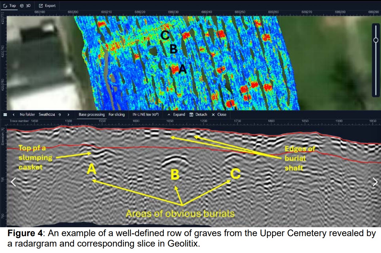
1. Ground Penetrating Radar (GPR)
Using the IDS GeoRadar Stream DP, the team emitted electromagnetic pulses into the ground at frequencies between 200 MHz and 1000 MHz.
Precision Mapping: By collecting data in a north-south grid, researchers created "time-slices"—top-down maps that reveal the subsurface at specific depths.
Depth & Detail: The GPR reached depths of 3.0 meters, allowing the team to identify not just the presence of a grave, but the distinct shapes of caskets and the edges of burial shafts.
2. Electromagnetic Induction (EMI)
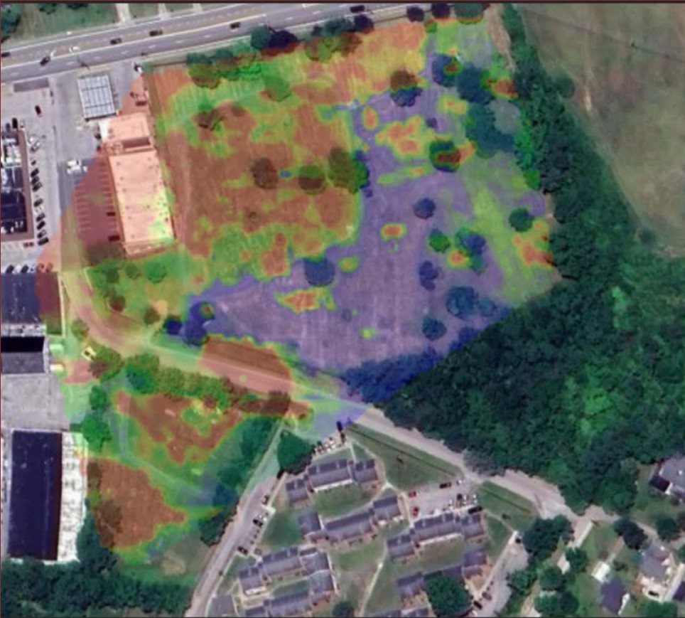
While GPR is excellent for finding objects, EMI helps scientists understand the "soil context".
Moisture and Hydrology: By measuring soil conductivity, the team could identify areas of high water saturation.
Supporting GPR: EMI data helped explain why some GPR signals were "faint." For example, the steep slopes at Green Hill are naturally drier and more eroded, which can mute the radar response of burials in those sections.
Key Discoveries from the investigation
The results of this high-tech "deep dive" revealed a much more populated cemetery than previously understood.
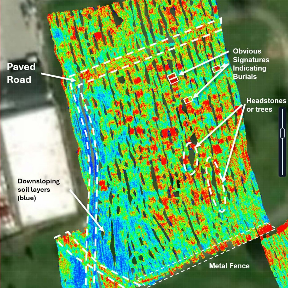
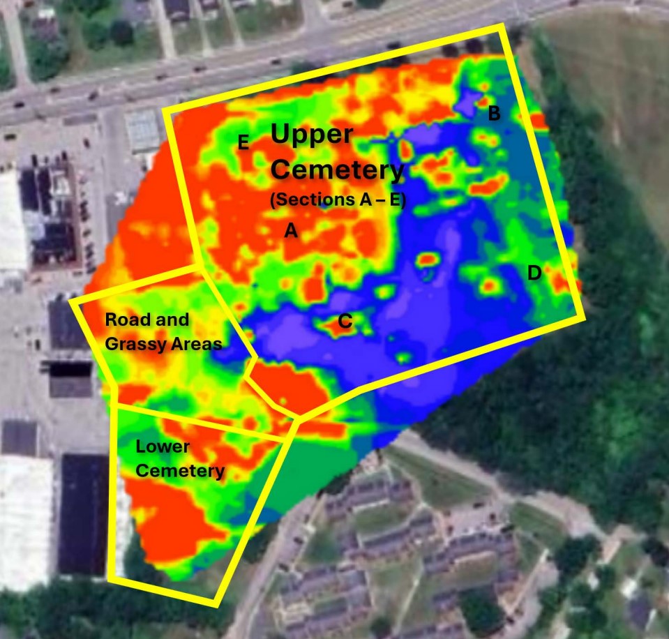
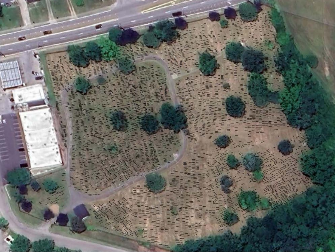
5,627 Probable Graves: The new analysis identified a total of 5,627 signatures consistent with burials—thousands more than shown on records
The "Upper Cemetery" (Sections A-E): This hilltop area is the most densely occupied, containing ~94% of the identified burials. Interestingly, while Area A (the highest point) has many surviving headstones, Area D (a steep slope) has very few, suggesting these may have been more modest, lower-income, or older burials that were separated from the main hilltop.
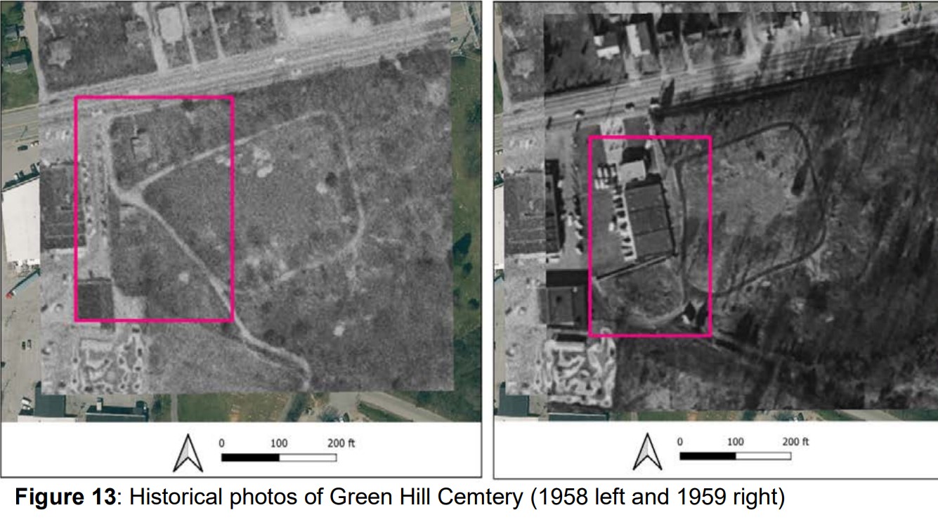
Evidence of "Lost" History: The report utilized aerial photography from 1958 and 1959 to show that a significant portion of the cemetery was destroyed for commercial strip-mall development. The current data helps identify where those damaged boundaries lie today.
The "Lower Cemetery": This section contains 257 burial signatures. These graves are generally larger and spaced further apart than those in the Upper Cemetery, which is consistent with it being a more recently opened portion of the grounds.
A Foundation for the Future
This investigation serves as more than just a map; it is a tool for dignity and management. By identifying "probable" locations where remains may be decomposed or where burials exist without markers, the project ensures that those who have become "unidentified" are never forgotten.
As the report concludes, while no geophysical survey is 100% perfect, this high-resolution model provides the strongest confidence yet for the long-term preservation of Green Hill Cemetery.