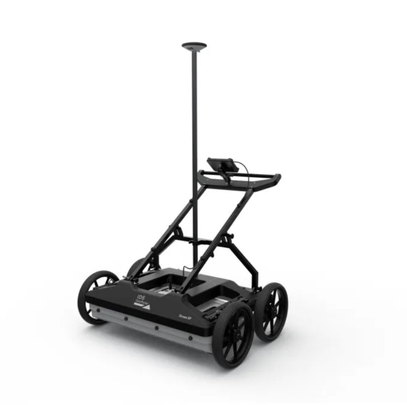
Leica IDS Stream DP: Redefining the Depths of Underground 3D Utility Mapping
Unearth unparalleled subsurface clarity and speed up your workflow with the Leica IDS Stream DP, the revolutionary multichannel Ground Penetrating Radar (GPR) array solution. Purpose-built for high-productivity underground utility surveys, the Stream DP eliminates traditional trade-offs by packing maximum depth penetration, ultra-high resolution, and massive multi-channel coverage into a remarkably lightweight, single-operator design.
Whether navigating busy urban asphalt or navigating challenging, rugged off-road terrains, the Stream DP empowers a single surveyor to efficiently map entire underground networks in a single pass.
Key Technical Distinguishers
Patented EsT (Equalized Scrambled Technology): Say goodbye to choosing between high resolution and deep penetration. IDS GeoRadar’s patented EsT exploits the full radiating performance of the antenna. By providing complete hardware equalization, it elevates deep subsurface signals to the same level as shallow targets, boosting depth penetration by 40% to 60% over standard GPR technology while maintaining ultra-high 3D clarity.
Massive Dual-Polarized 30-Channel Array: Equipped with a 600MHz massive array featuring 30 channels in double polarization (19VV + 11HH). This enables dense, accurate 3D reconstructions of complex utility networks in a single scan with a wide 82.5 cm scan footprint, drastically eliminating missed targets.
True Single-Operator Portability: While traditional multichannel arrays require heavy vehicles or a large crew, the Stream DP features a modular, ergonomic design weighing a maximum of 20 kg per component (42 kg total system weight). It easily fits into a standard civilian vehicle and can be fully assembled by just one operator in under 5 minutes.
Multi-Environment Adaptability: Transition effortlessly between field conditions. The user-configurable system allows you to rapidly switch between Asphalt Configuration (utilizing highly maneuverable pivoting wheels) and Rugged Terrain Configuration (featuring rugged off-road wheels and adjustable antenna height) to handle uneven dirt, grass, or rail corridors.
Non-Stop Performance & Hot-Swap Power: Engineered for demanding all-day shifts with incredibly low power consumption (15W–19W). Featuring hot-swappable battery technology, the system allows you to exchange power sources on the fly without stopping your survey or losing data synchronization.
High-Precision Synchronization: Integrated Pulse-Per-Second (PPS) and encoder tracking enable seamless synchronization with external GPS and TPS systems, ensuring your 3D point cloud and data alignment maintain absolute geographical precision.
Software & Complete Ecosystem Integration
The hardware performance is complemented by a powerful software suite designed to compress the time from field collection to final deliverable:
uMap On-Field Software: An intuitive, rapid-start interface for easy real-time data collection, automatic calibration, and live radar tomography view right on the field tablet.
IQMaps Post-Processing Software: Advanced 3D processing software featuring smart cloud integration, allowing for accelerated data analysis and direct export workflows into standard CAD environments.
Maximize your survey capabilities and underground productivity. The Leica IDS Stream DP provides the ultimate competitive edge by uncovering deeper assets, faster, with data you can trust.