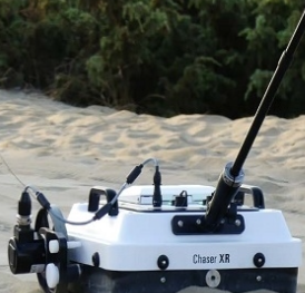
The Leica IDS Chaser XR Lite Kit is an ultra-portable, high-performance Ground Penetrating Radar (GPR) system engineered for rapid, high-resolution subsurface utility mapping and structural investigations. Designed specifically for utility locators, civil engineers, and environmental surveyors, the Chaser XR Lite delivers an exceptional balance of deep penetration and shallow target resolution, allowing field crews to clear excavation zones and map buried assets with absolute confidence.
Featuring an innovative, lightweight configuration, this kit strips away the bulk of traditional GPR systems without sacrificing data quality. With its agile deployment options—including a handheld pulling pole and a precision survey wheel—the Chaser XR Lite Kit excels in rugged off-road terrains, congested urban jobsites, and tight spaces where larger cart systems cannot maneuver.
Key Features & Benefits
Extended Range (XR) Dual-Target Resolution: Built on advanced radar architecture, the Chaser XR antenna captures both shallow, high-detail infrastructure (such as fiber optic cables and small conduits) and deep assets (such as water mains and concrete pipes) simultaneously.
Ultimate Lightweight Portability: Optimized for single-operator transport and deployment, the "Lite Kit" configuration features a streamlined build that reduces user fatigue during long field shifts.
Versatile Pulling Pole & Survey Wheel: Adapt instantly to your environment. Use the rugged 50cm survey wheel kit for precision distance tracking on paved surfaces, or switch to the lightweight pulling pole to sweep across rough, unpaved terrains, grass, and dirt.
Heavy-Duty Protective Enclosures: Protect your investment. The kit includes a premium HPRC heavy-duty hard case and a specialized Chaser XR rigid case to safeguard delicate electronics, cables, and antennas during transit across demanding job sites.
All-Inclusive Field Kit Components: Comes fully equipped for immediate deployment right out of the box, featuring the core Chaser XR antenna, high-fidelity connection cables, field-ready batteries, and a dedicated multi-bay battery charger.
Advanced 3D Mapping Scalability: Pair seamlessly with Leica’s high-performance field software and post-processing engines, like Leica IQmaps, to transform raw radar profiles into comprehensive 3D subsurface utility maps and CAD-ready deliverables.
Technical Specifications
| Feature | Specification |
| System Profile | Leica IDS Chaser XR (Extended Range) Architecture |
| Deployment Options | Integrated Survey Wheel (50cm) & Lightweight Pulling Pole |
| Primary Enclosures | Premium HPRC hard case & Chaser XR rigid field case |
| Power Management | High-capacity field batteries with included intelligent charger |
| Data Interfacing | Heavy-duty, shielded connection data cables |
| Environmental Protection | Built to withstand demanding, rugged outdoor field conditions |
| Compatible Add-ons | Leica IDS Chaser XR Pushcart, Drag Kit, and IQmaps Perpetual Licenses |
Common Field Applications
Subsurface Utility Engineering (SUE): Detect and map complex underground utility networks—including non-metallic PVC conduits, clay pipes, and fiber optic lines—before executing directional drilling or trenching.
Excavation Clearing & Hazard Avoidance: Conduct rapid grid sweeps across construction corridors to clear paths for heavy machinery, minimizing the risk of hazardous utility strikes.
Geotechnical & Environmental Surveys: Identify buried storage tanks, sub-surface voids, historical foundations, and anomalies across changing soil compositions.
Confined Space & Rough Terrain Scanning: Maneuver effortlessly along steep embankments, narrow trenches, and highly congested urban spaces where traditional 4-wheel GPR carts fail to fit.