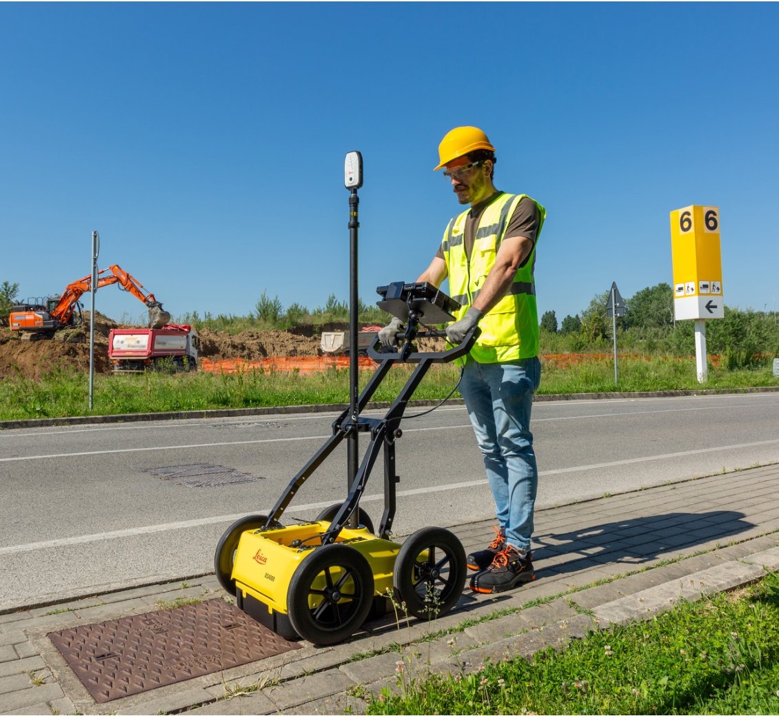
As our urban spaces become increasingly congested, the ground beneath our feet hides a complex and tangled network of pipes, cables, and other assets. For professionals in construction and surveying, breaking ground without precise knowledge of what lies beneath is a significant risk. Leica Geosystems is addressing this challenge head-on with the revolutionary Leica DS4000 Utility Detection Radar.
Revolutionary Depth and Clarity with EsT Technology
At the heart of the Leica DS4000 is the patented Equalised Scrambling Technology (EsT). This groundbreaking innovation fundamentally changes what's possible in ground penetrating radar (GPR). Traditional systems often struggle with depth and clarity, but EsT allows the DS4000 to identify underground assets up to 60% deeper.
This technology boosts the penetration depth and delivers crystal-clear results across an extended range. It enables the detection of even the most difficult-to-see objects, such as fibre optic cables, at both shallow and deep levels, ensuring no potential threats are missed.
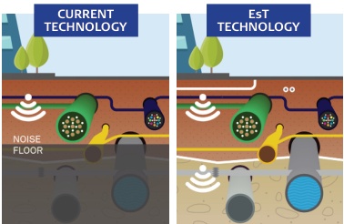
EsT technology cuts through signal noise to provide unparalleled clarity compared to conventional systems.
Engineered for Efficiency in the Field
The Leica DS4000 is not just powerful; it's designed with the user in mind. Its features are built to streamline field operations, save time, and reduce costs.
Modular and Compact Design
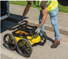
Weighing only 20 kg (44 lb), the DS4000 features a lightweight, modular, and compact design. Its foldable handlebar makes deployment, storage, and transport effortless, allowing for easy maneuvering by a single operator.
Streamlined Digital Workflow
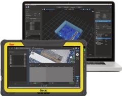
The innovative "Quick Scan Mode", powered by the uMap field software, accelerates data collection. It allows for real-time, on-site marking and digitalization of detected anomalies. This means you can create and finalize reports directly in the field, dramatically improving your workflow efficiency.
Other Key Innovations:
- Uninterrupted Operation: Hot-swap technology for the power supply ensures you can work through the entire day without interruption.
- Optimal Performance: An easy-to-switch antenna polarization (HH and VV) guarantees the best performance in various soil conditions and for different target types.
- All-Terrain Adaptability: A height-adjustable antenna and optional rugged, off-road wheels allow the system to easily overcome obstacles and perform reliably on challenging terrains.
A New Standard in Utility Detection
The Leica DS4000, with its advanced EsT technology and intelligent design, represents a significant leap forward for utility detection. By providing a clearer, deeper, and more accurate overview of underground networks, it enhances worker safety, prevents costly excavation strikes, and minimizes disruption to communities.
The future of utility mapping is here, offering unmatched resolution and extraordinary depth investigation to help you see more and reach deeper than ever before.
As our urban spaces become increasingly congested, the ground beneath our feet hides a complex and tangled network of pipes, cables, and other assets. For professionals in construction and surveying, breaking ground without precise knowledge of what lies beneath is a significant risk. Leica Geosystems is addressing this challenge head-on with the revolutionary Leica DS4000 Utility Detection Radar.
Revolutionary Depth and Clarity with EsT Technology
At the heart of the Leica DS4000 is the patented Equalised Scrambling Technology (EsT). This groundbreaking innovation fundamentally changes what's possible in ground penetrating radar (GPR). Traditional systems often struggle with depth and clarity, but EsT allows the DS4000 to identify underground assets up to 60% deeper.
This technology boosts the penetration depth and delivers crystal-clear results across an extended range. It enables the detection of even the most difficult-to-see objects, such as fibre optic cables, at both shallow and deep levels, ensuring no potential threats are missed.
EsT technology cuts through signal noise to provide unparalleled clarity compared to conventional systems.
Engineered for Efficiency in the Field
The Leica DS4000 is not just powerful; it's designed with the user in mind. Its features are built to streamline field operations, save time, and reduce costs.
Modular and Compact Design
Weighing only 20 kg (44 lb), the DS4000 features a lightweight, modular, and compact design. Its foldable handlebar makes deployment, storage, and transport effortless, allowing for easy maneuvering by a single operator.
Streamlined Digital Workflow
The innovative "Quick Scan Mode", powered by the uMap field software, accelerates data collection. It allows for real-time, on-site marking and digitalization of detected anomalies. This means you can create and finalize reports directly in the field, dramatically improving your workflow efficiency.
Other Key Innovations:
- Uninterrupted Operation: Hot-swap technology for the power supply ensures you can work through the entire day without interruption.
- Optimal Performance: An easy-to-switch antenna polarization (HH and VV) guarantees the best performance in various soil conditions and for different target types.
- All-Terrain Adaptability: A height-adjustable antenna and optional rugged, off-road wheels allow the system to easily overcome obstacles and perform reliably on challenging terrains.
A New Standard in Utility Detection
The Leica DS4000, with its advanced EsT technology and intelligent design, represents a significant leap forward for utility detection. By providing a clearer, deeper, and more accurate overview of underground networks, it enhances worker safety, prevents costly excavation strikes, and minimizes disruption to communities.
The future of utility mapping is here, offering unmatched resolution and extraordinary depth investigation to help you see more and reach deeper than ever before.