In the world of modern construction and renovation, what you don't see can be just as critical as what you do. For high-rise commercial projects, the complexity of suspended concrete slabs—filled with layers of reinforcement, structural foam, and sensitive utilities—demands more than just a standard inspection.
A recent structural investigation of a premier high-rise development serves as a perfect example of the Scan to BIM (Building Information Modeling) process in action. By leveraging Ground-Penetrating Radar (GPR) and digital modeling, engineering teams are now able to create "digital twins" of internal slab structures, significantly reducing risk and improving project outcomes.
The Challenge: Navigating the "Concrete Labyrinth"
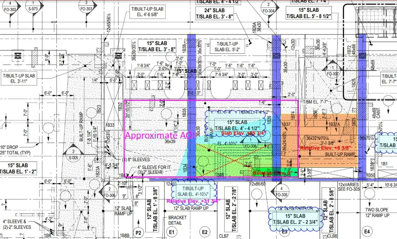
When dealing with massive, modern structures, structural engineers often face a "blind spot." Existing blueprints may be outdated or lack the granular detail needed for new coring or structural modifications. In this case study, the goal was to map the reinforcement layout within a heavily reinforced slab to ensure safe navigation for future site work.
The Process: From Radar Pulses to 3D Intelligence
The "Scan to BIM" workflow transforms raw data into actionable insights through three key phases:
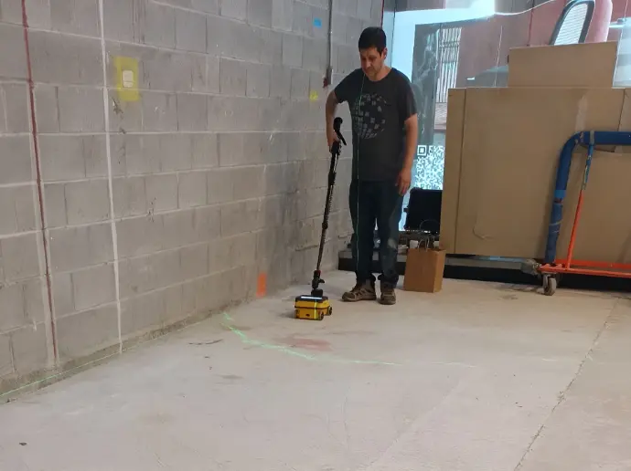
Precision Data Capture: Using high-resolution GPR systems (such as the IDS C-Thrue), technicians scan the slab surface. Unlike X-rays, GPR is non-destructive and requires access to only one side of the slab—a critical advantage in occupied commercial spaces.
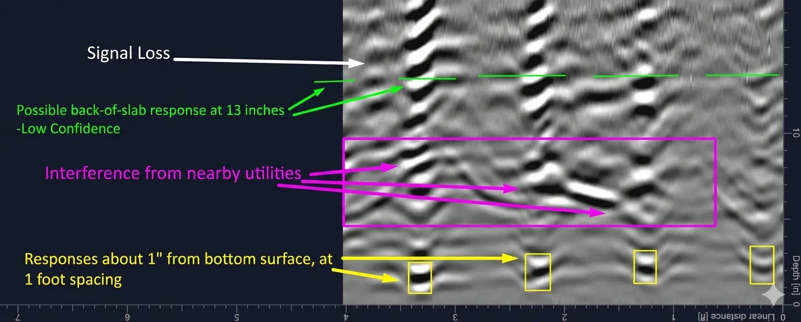
Data Processing and Interpretation: Raw radar reflections are processed through specialized software to filter out "noise." This allows experts to distinguish between standard rebar, structural voids, and radio-negative materials like foam.
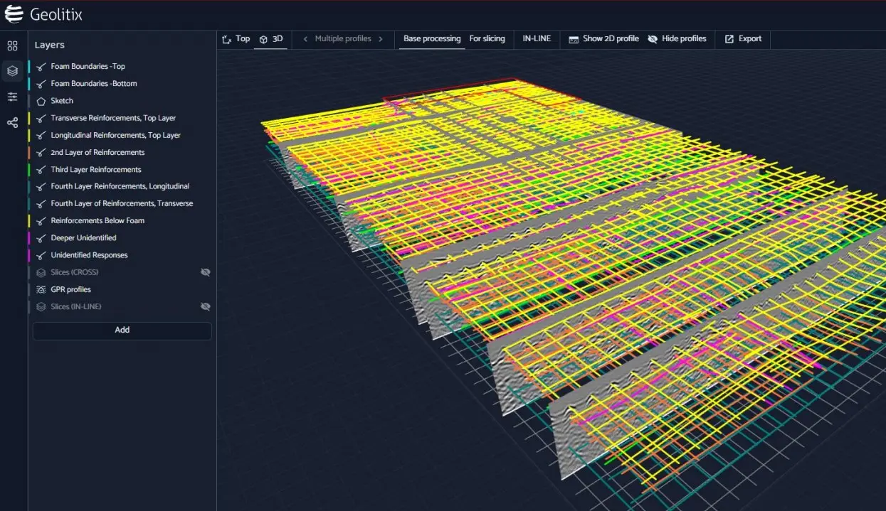
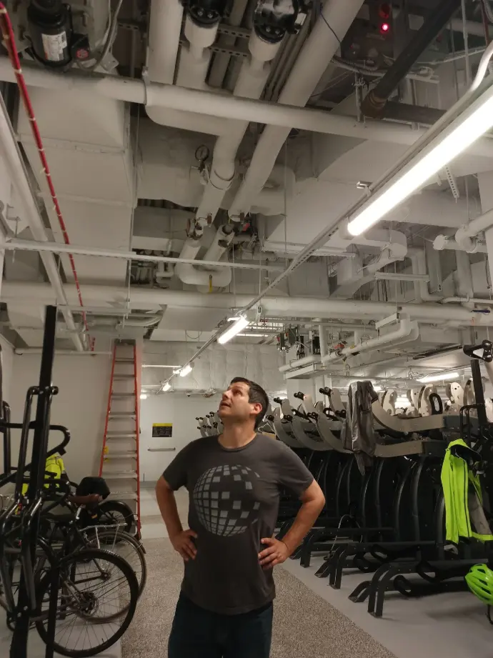
BIM Integration: The interpreted data is then exported into a 3D BIM environment. This creates a digital record of the slab’s internal geometry, allowing stakeholders to visualize the exact position of every reinforcement layer in relation to the building’s overall MEP (Mechanical, Electrical, and Plumbing) systems.
Use Precise Technology
Adapt to Site Conditions
Key Insights from the Investigation
The investigation of this landmark site revealed a highly complex internal landscape that traditional methods would have missed:
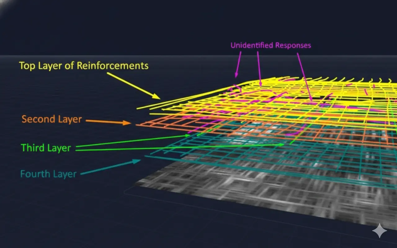
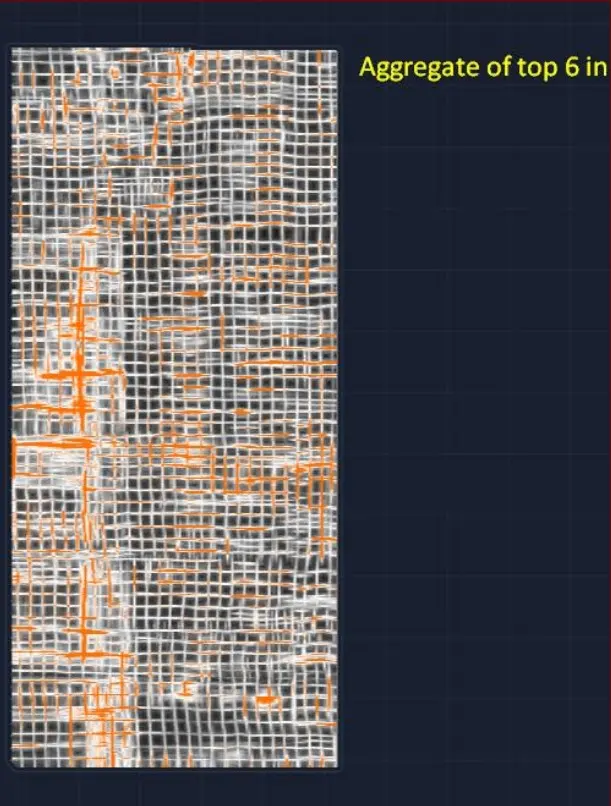
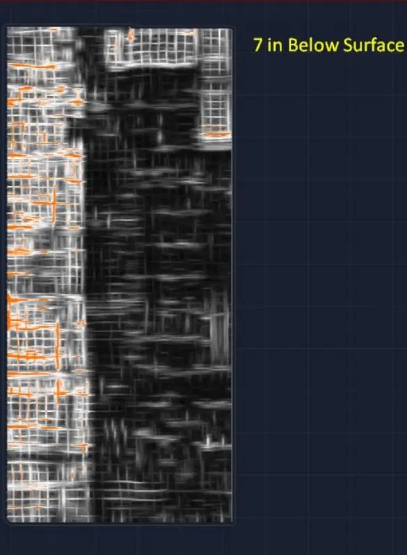
Multi-Layer Mapping: The scans identified four distinct layers of reinforcement at varying depths and spacings (ranging from 1-foot to 4-foot intervals).
Material Identification: The team successfully mapped structural foam mats in specific zones, identified by their unique "air pocket" radar signatures.
Risk Mitigation: By identifying "safe to core" zones and mapping unidentified utility responses, the team provided a roadmap that prevents costly "strikes" to live conduits or critical reinforcements.
The Potential: Why GPR-to-BIM Matters
This process is about more than just safety—it's about the lifecycle of the building.
Precision Planning: Architects and engineers can design renovations based on the actual as-built conditions of the slab, not just theoretical drawings.
Clash Detection: By having a 3D model of the internal slab, new utilities can be routed digitally to avoid internal obstructions before a single drill hits the floor.
Long-Term Asset Management: The resulting BIM model serves as a permanent digital record, simplifying maintenance and future upgrades for decades to come.
Conclusion
As structures grow more complex, the "Scan to BIM" process is becoming the gold standard for structural integrity. By turning the invisible interior of a concrete slab into a clear, digital asset, geophysical experts are providing the precision and peace of mind necessary to build—and renovate—with total confidence.